水災害リスクコミュニケーションポータルサイト
https://www.mlit.go.jp/river/risk_communication/about_flood05.htmlBundle the HTML, screenshot, summaries, and metadata into one ZIP file. The first export request adds an external RFC 3161 timestamp before download.
水災害リスクコミュニケーションポータルサイト
Open the dedicated viewer to inspect the saved page with archive metadata pinned above it.
This is a self-contained HTML copy with CSS and images embedded, so it still renders even if the original page disappears.
The dedicated viewer keeps the original URL and saved timestamp visible while you review the archived HTML.
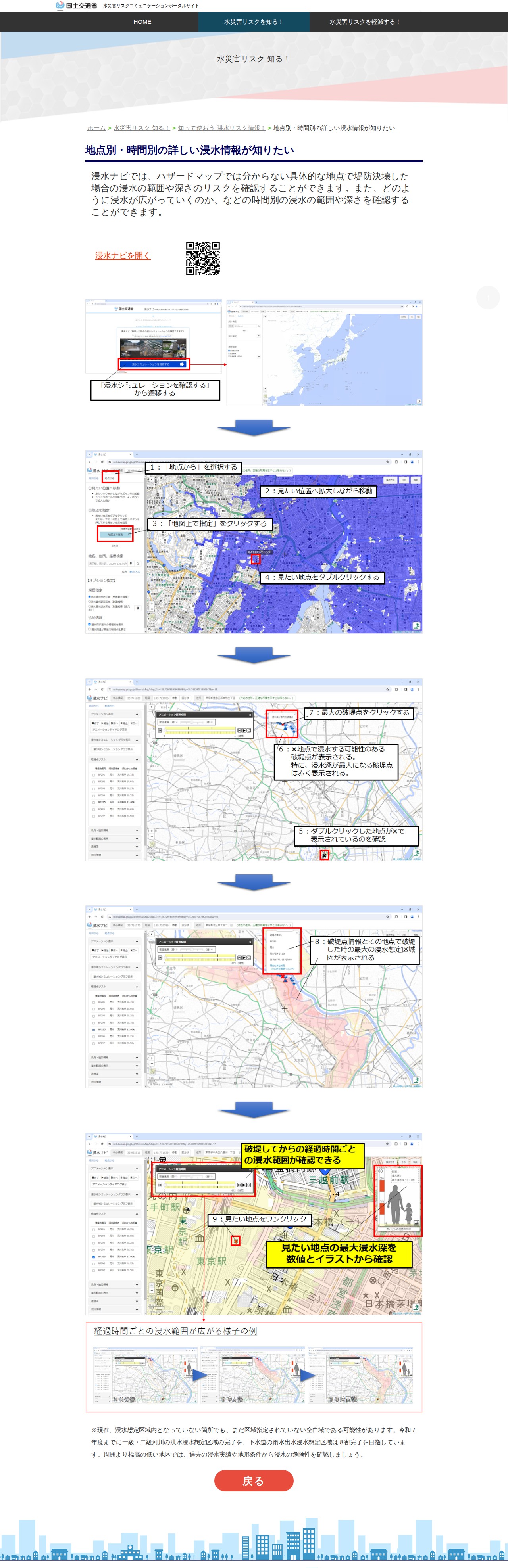
This page is an overview of the Ministry of Land, Infrastructure, Transport and Tourism's Water Disaster Risk Communication Portal Site. It provides information to help people understand and mitigate water disaster risks such as flooding. The "Inundation Navigator" allows users to confirm specific inundation ranges and depths during levee failures, as well as temporal changes in flooding spread—details not available on traditional hazard maps. The government aims to complete flood inundation zone designations for primary and secondary rivers by fiscal year 2025, with 80% completion targeted for sewage rainfall inundation zones.