水災害リスクコミュニケーションポータルサイト
https://www.mlit.go.jp/river/risk_communication/about_flood.htmlBundle the HTML, screenshot, summaries, and metadata into one ZIP file. The first export request adds an external RFC 3161 timestamp before download.
水災害リスクコミュニケーションポータルサイト
Open the dedicated viewer to inspect the saved page with archive metadata pinned above it.
This is a self-contained HTML copy with CSS and images embedded, so it still renders even if the original page disappears.
The dedicated viewer keeps the original URL and saved timestamp visible while you review the archived HTML.
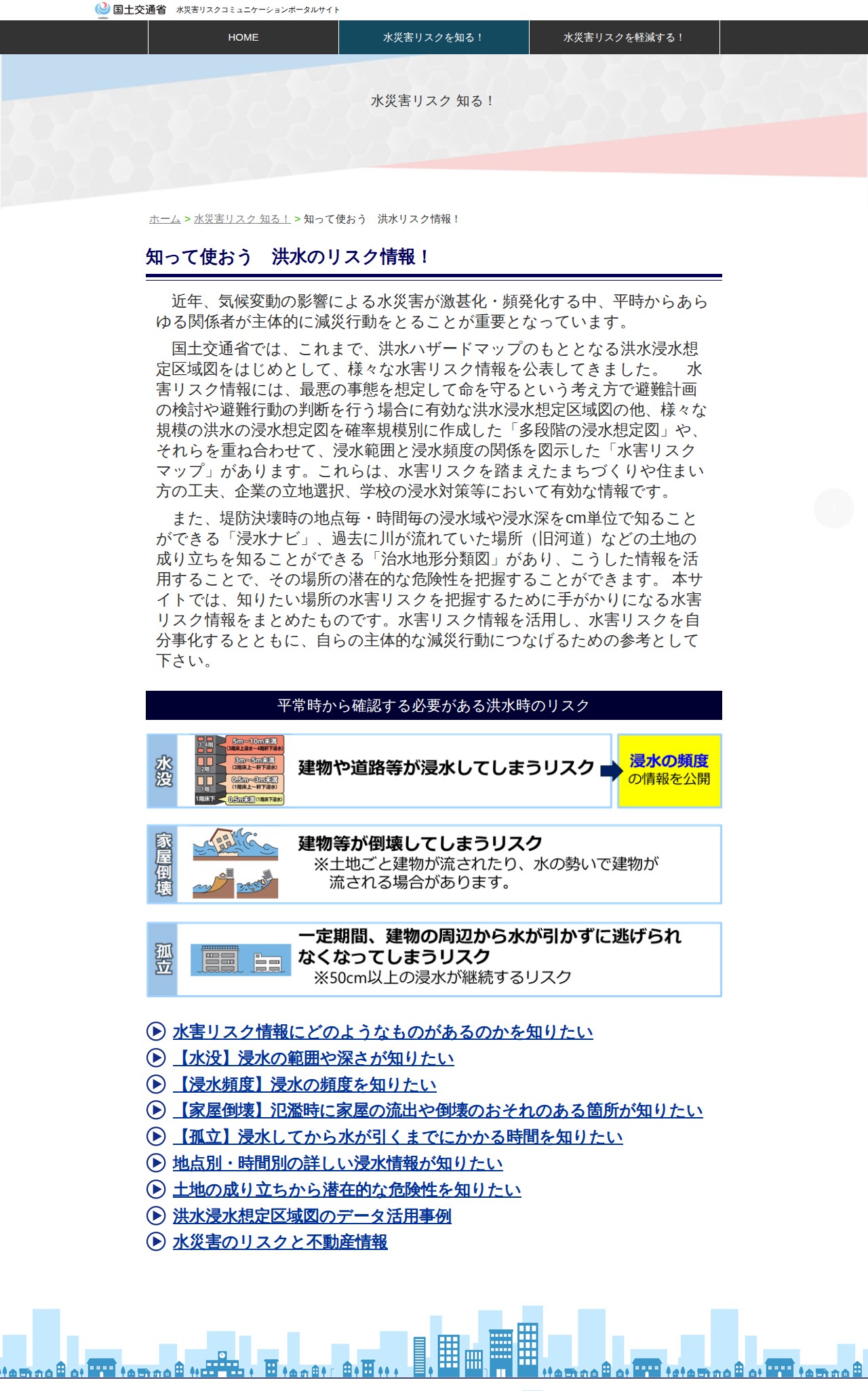
This page is a portal site providing flood risk information developed by Japan's Ministry of Land, Infrastructure, Transport and Tourism. It offers various tools including flood inundation maps, multi-stage flood prediction diagrams, and flood risk maps to help users understand flood hazards. Users can access information about inundation range, depth, frequency, risk of house collapse, and isolation duration. The site aims to help individuals and companies recognize flood risks and take proactive disaster mitigation actions in response to increasing severe weather events.